 There is no comparison with mountain scenery of Hunza – Nagar rising dramatically in the valleys surrounded by peaks over 7000 mtrs – the villages of both the former states now districts, rose on mineral rich moraine rocks with abundance in crop yields. Due to scarcity of land terracing of fields is commonly seen throughout the countryside. These valleys are full of fruits like apricots, almonds, peaches and pears. The staple food was once healthy buckwheat, barley and corn however with the beginning of the Karakoram Highway(KKH) life style has undergone a drastic change giving way to imported products from other parts of the country. Generally due to pollution free atmosphere and healthy life style people show strong body build have longer lives comparatively than the settled parts of the country.
In 1891 the British Indian Empire was expanding its control throughout the sub-continent, grew worried with expansionist designs of the Czar of Russia who had started a campaign for controlling Eastern Turkestan presently its major part is called Xinjiang while western part comprised of Ferghana valley and the towns of Samarkand and Bukhara. British had already negotiated an agreement for the control of these valleys with the rulers of Hunza and Nagar but the presence of British forces was seen as an act of hostility. They attacked the fort in Chalt which was the border between the states of Hunza and Nagar and Gilgit already in control of the British forces. This forced the British who proceeded to dislodge the two state soldiers from their strongholds and first was attacking Nilt Fort in 1893 where the rebel forces were routed and Mir of Hunza had to flee to China while his half brother was installed as the Mir of Hunza. Since then Hunza and Nagar submitted to British control till borders with China.
The drastic change in the life of the people started with the construction of highway by the Chinese who see this as of strategic commercial artery giving access to the sea. The recent initiative of the Chinese Govt of ‘One Road One Belt’ has full endorsement of the Govt of Pakistan which considers it as one of the pillars of its economy.
The immense mountain panorama of this part is stunning beauty one can never see elsewhere. This part has the greatest concentration of high altitude peaks within a small region. Touring into these valleys and exploring the villages and folk life is greatest attraction one feels in the quiet of mountains with eternal snows.
Itineraries
Day 01: Arrive Islamabad – Flt
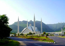 Meeting on arrival by an early flight at Islamabad International airport. Transfer to your hotel. Later in the day orientation tour of Islamabad and surroundings. o/n
Day 02: Islamabad – Besham – 268 kms
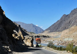 We shall start our adventure by driving through Abbotabad on the Karakoram Highway(KKH)
The first part of our journey is least interesting but soon after leaving the busy traffic we head into mountains through Battagram with its beautiful rice terracing gives it a great view. We shall make several photo stops on the road. Our arrival at Thakot will be the first sight of River Indus rising in the high mountains of Himalayas near Ladakh in the western part of Tibet. On arrival transfer to hotel. o/n
Day 03: Besham – Chilas – Gilgit – 335 kms
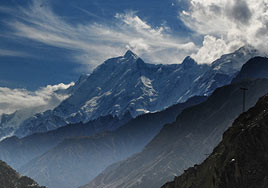 Continuing on the KKH we head into more mountainous part – after a journey of 80 kms we shall be travelling through the Indus Gorge as the valley narrows with increase in the ferocity of river. This is a great shot of the gorge which is greener part but gradually as we move further from Dasu the terrain tends to be drier mountains with decrease in greenery. We shall be making a stop at Shatial Bridge to see the largest collection of rock drawings. From here we pass through the most drier part on the road but while nearing Chilas we suddenly see mountains with eternal snows. Our first sight of mountain Nanga Parbat (8125m). Today we shall be making quite a few photo stops on the road – the best point on the road will be a stop at Thaliche whereas we can see mountain ranges of Nanga Parbat, Haramosh and Rakaposhi envious site for a photographer. The next stop will be at the confluence where mighty River Indus and Gilgit River meet marking the collision of two continents that resulted in the high rising mountains. Later a short drive will bring us to Gilgit town and transfer to your hotel. o/n.
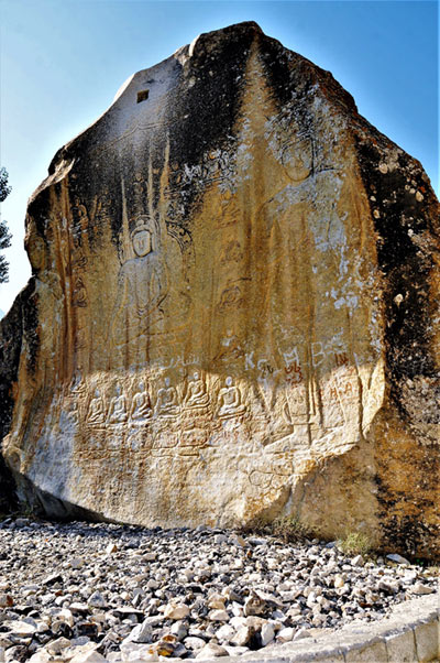
Rock Drawings along Karakorum Highway:
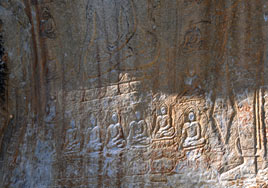 From late bronze period 300 BC this part must have been visited by the early settlers or
hunting groups which were mainly Scythians from Altai region whose implements and their
traditional animal decorative art was found in a village on the KKH. Much later around 3rd to 5th AD Buddhist pilgrims left their marks on the rocks what we see today at Shatial rock drawings.
This Visitors Book activity continues through 7th 8th century when Buddhist pilgrims must have used the route crossing Indus River over wine twig bridges was a great feat marked with holy prayers depicted on the rocks, we see today. A more closer look will reveal that there are inscriptions in Kharoshti, Chinese and Gupta scripts testifying the origins of the travelers on the road from Swat valley known by then as Uddiyana of the Buddhists to Kashmir. From here we shall see many places with rock inscriptions and drawings mostly seen where the river flow is slower or narrower. We shall speak further on the rock drawings.
Day 04: Gilgit – Karimabad – 110 kms
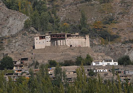 In the morning we shall make a short visit of Gilgit bazaar the Old Bridge and rock carving of Buddha at Kargah dating 8th or 9th AD. Later depart for Hunza valley on the KKH – it will be interesting to see how road has been transformed from a mere jeepable drive to wide modern road and no wonder the road has played an important role in the life of local people who used to be cut off from the mainland for most part of the year. As we mark entry into the main valley of Hunza Nagar it opens up with a surprising view of Rakaposhi peak (7788m) overlooking the whole valley. Further as we approach Karimabad we shall see more mountains and the village of Baltit lies in the lap of Ultar Peak (7388m) overlooking another great sight of the valley. On arrival transfer to hotel. o/n
Day 05: Karimabad
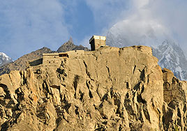 We shall spend a great day by visiting Baltit and Altit villages – we shall start a walking tour to the oldest part of Karimabad known as Baltit which has been partly preserved under a program of the Aga Khan Heritage Trust. A walk through the old part is just great – stop at the old mill house and then walk up to Baltit Fort Museum – perched on a high point overlooks the whole valley with wonderful views. Afterwards we shall drive down to Altit village and walk through to Altit Fort situated on a precipice with a steep fall. Next we shall drive up to Duikar for a grand view of the whole valley. This will be a nice place for dinner on a full moon night. o/n
Day 06: Karimabad – Gulmit – 30 kms
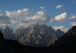 We shall depart for the upper valley of Hunza – out stop will be at Gulmit village and after settling our luggage at the hotel we shall start our hike to Ghulkin village. These are yet another sight of great views of Passu Peaks and Gojal Dolomites!
Today we shall be visiting a local family house and enjoy local food in a traditional house Return to your hotel. o/n
Day 07: Gulmit
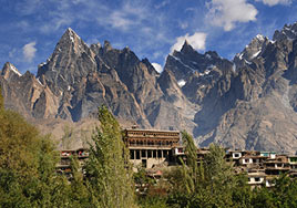 Today we shall be relaxing and for those willing to take hike to Passu glacier will be escorted to the site with fascinating views of Passu peak. o/n
Day 08: Gulmit – Minapin
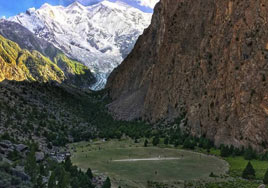 This morning we shall depart for a more closer look of Rakaposhi peak to Minapin village which is closest distance to Minapin glacier of Rakaposhi Peak afternoon hikes to cricket ground (was an open space now designated as highest cricket ground) Today we shall make special home make food cooked in traditional stone pots. Also interact with the family members. o/n
Day 09: Minapin
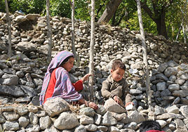 Today we shall have the opportune moment to explore the local village – interact with the
villagers and visit a local house. The people of Minapin are very hospitable and this will be an excellent experience to share your thoughts with them and know their customs and traditions. This is also a great hiking opportunity for those who wish to hike to the glacier for a more closer look at the Rakaposhi mountain.
Today we shall have the opportune moment to explore the local village – interact with the
villagers and visit a local house. The people of Minapin are very hospitable and this will be an excellent experience to share your thoughts with them and know their customs and traditions. This is also a great hiking opportunity for those who wish to hike to the glacier for a more closer look at the Rakaposhi mountain.o/n
Day 10: Minapin – Gilgit – 100 kms
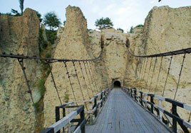 Drive to Gilgit with short stops enroute – we shall make short stop at Daniyor village to see a rock with Chinese inscription. This is least visited site owing to its placing in a private house but this inscription is of immense importance. It says about a Chinese prince who ruled here and talks about his subjects and local conditions. We shall drive through the tunnel on exciting hanging bridge with wonderful view of the Hunza river before joining Gilgit river downstream. Later pass through old bazaar of Gilgit and after a short stroll and to see if there is polo practice happening in the late afternoon will be nice chance to see polo in its real form. Later transfer to your hotel. o/n
Day 11: Gilgit – Islamabad – Flt
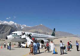 We shall take the flight out of Gilgit – this will be an exciting and wonderful chance to see a beautiful mountain flight one may envy in a life time. The flight route goes through beautiful mountain panorama once it rises above the mountain heights – views Naga Parbat are superb always on your left side out of Gilgit flying over Gilgit river. On arrival transfer to your hotel. o/n
Note: Flight to/fro Islamabad is subject to weather and back log conditions. If our flight plan is disturbed then we shall drive through Kaghan valley to Islamabad with an overnight enroute.
Day 12: Islamabad
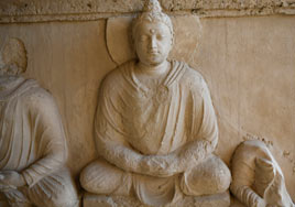 Today we shall take an excursion into time line of history to Taxila – dating from 6th BC to 6th AD. Taxila is well preserved archaeological site with three city sites and Buddhist monasteries and stupas sites worth visiting. We shall visit a 1st BC Jandial temple the so call Greek temple site and couple of city sites. Return to Islamabad. o/n
Day 13: Islamabad – Depart – Flt
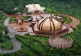 Transfer to Islamabad International airport for your destination flight. Assistance on departure
Tour Highlights:
Islamabad – Karakoram Highway – Indus valley rock drawings(Shatial bridge) – Nanga Parbat (8125m) – Thaliche view point of three peaks – Hunza Nagar valley – Baltit Village & Fort – Hunza Valley – Upper Hunza – Gojal cones – Ghulkin village visit – Minapin glacier – Gilgit polo – flight Gilgit/Islamabad – Taxila step back in history.Gallery
View the embedded image gallery online at:
https://ahutravelntourism.com/index.php?option=com_content&view=article&id=238&Itemid=672#sigProId2df464dc0e
https://ahutravelntourism.com/index.php?option=com_content&view=article&id=238&Itemid=672#sigProId2df464dc0e


